v2.5 [Sep 17, 2014]
Terra-formed 3D UTM tiles.
v2.3 [May 31, 2013]
The new features in brief:
Georeferencing option using Triangulated Irregular Networks for distorted maps and plans.
Option to save pre-processed raster image (cropping, resolution) as a file before georeferencing.
Support for MicroDEM format version 3.
Enhanced GeoTIFF export option for DEMs with support for geographic coordinates.
Live track log option for GPS devices.
Export option for georeferenced raster maps as a .kmz package for some Garmin® GPS models.
Documentation: New tutorial for TIN georeferencing.
Documentation: New tutorial for USGS National Map WMS.
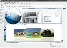
Plan your building and furnishing projects on your PC withAshampoo 3D CAD Pro 3.